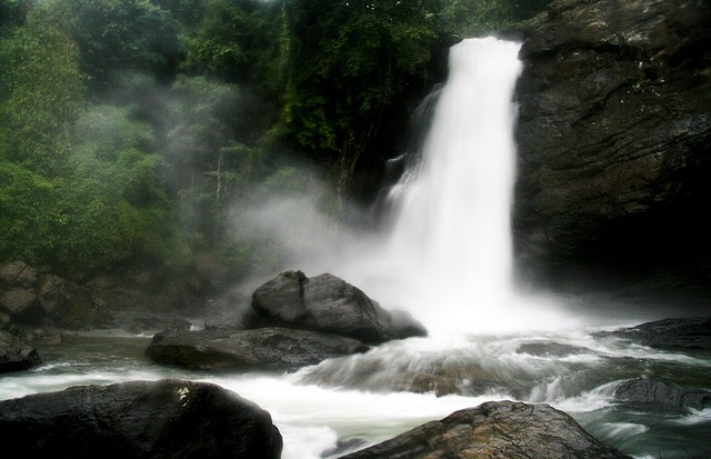
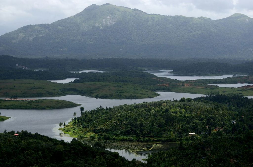
Nestled among the mountains of western ghats, lies Wayanad, [also called as Wynad, Wayanadu, Wyanad, Vayanad, Vayanadu, Vynad etc] one of the most loveliest hill station of Kerala. This green paradise is located at a distance of 76 kms from the nearest sea-shore of Kozhikode. The hills, rocks and valleys which give shape to the very unique terrain of Wayanad provide for exceptional adventure experiences. Mountains and forests intersperse to create numerous outback trails, trekking routes and opportunities for other adventure sports. With vast areas still unexplored, Wayanad is truly an adventurescape waiting to be discovered. Come..Explore Wayanad..
The name Wayanad is believed to be derived from the word Vayalnadu, which means “the land of paddy fields”. The present district of Wayanad was carved out from the parts of Kozhikode and Kannur districts which came into being on 1st November 1980 as the 12th district of Kerala.
This district is perhaps one of the biggest foreign exchange earners of the State, thanks to its cash crops of pepper, cardamom, coffee, tea, vanilla, spices and other condiments.
Wayanad is one of the districts in Kerala that have been able to retain its pristine nature. Wayanad is known for its picturesque mist-clad hill stations, sprawling spice plantations, luxurious forests and rich cultural traditions. The leading tourist centres of South India like Ooty, Mysore, Coorg and Kannur are around this region.
The deciduous forests of Wayanad is famous for woody climbers like Entada scandens, Calycopteries floribunda etc. With 26% forest cover, far greater then any district in Kerala, Wayanad is home to two major wildlife sanctuaries: Muthanga and Tholpetty. Taken together, these two sanctuaries are home to an incredible range of flora and fauna, including several endangered species. A past of the Western Ghats, they constitute an important swathe of the last surviving tracts of an unique ecosystem. For wildlife enthusiasts and nature lovers, Wayanad’s wildlife sanctuaries are must visit destinations.
Blessed and gifted by Nature – Tholpetty, Muthanga, Bandipur, Muthumala (Wildlife Sanctuaries), Kanthanpara, Sentinel Rock (Waterfalls), Edakkal caves, Pookot lake, Chembra peak, Kuruvadweep, Pakshipathalam etc…
General details
Area: 2126 sq km.
Location: Located between North Latitude 11°47′ & 15°58′ and East Longitude 75°47′ & 70°27′, district of Wayanad is on the southern tip on the Deccan plateau.
Altitude: 700-2100 mts above mean sea level.
Temperature: 13°c – 32°c
Main crops: Coffee, Pepper, Tea, Rubber, Cardamom, Vanilla, Arecanut, Ginger, Plantain
Climate: Uniform pleasant climate throughout the year
Clothing: Light summer wear for most of the year. Between Dec & Feb, carry warm clothes.
Language: Malayalam is the local language. English and Hindi are widely spoken and understood. Kannada and Tamil are also understood towards border region.
STD codes: Mananthavady :: ++91 (0)4935
Kalpetta & Other :: ++91 (0)4936
Where to stay: Please check the Accommodation page. A few BAR hotels are available in Wayanad.
Taluks: 3 (Vythiri, Mananthavady, Sulthan Bathery)
Municipality: 3 (Kalpetta, Mananthavady, Sulthan Bathery)
Grama Panchayaths: 23 Scroll down to know
Block Panchayaths: 3
District Head Quarters: Kalpetta
Assembly Constituencies: 3 (Kalpetta, Sulthan Bathery, Mananthavady)
Parliament Constituencies: 1 (Wayanad)
Boundaries
East: Nilgiris, Mysore
North: Coorg, Kannur
South: Kozhikode, Malappuram
West: Kozhikode, Kannur.
Accessing Wayanad
Air: Nearest Airport: Kozhikode (Karipur)
Rail: Nearest Railway Station: Kozhikode [Rail distances from major cities to Kozhikode are-
New Delhi:2851 Km; Mumbai: 1425 Km; Kolkata: 2331 Km; Ahmedabad: 1875 Km; Hyderabad: 1425 Km]
Road: Well connected by roads from Kozhikode (Ghat-72 Km from Kalpetta), Kannur (Ghat), Ooty (120 Km from Kalpetta) and Mysore (140 Km from Kalpetta). Please check the distance page.
Routes
Kanyakumari-Thiruvananthapuram-Kollam-Alappuzha-Kottayam-Ernakulam-Thrissur-Kozhikode-Lakkidi-Kalpetta
Kovai (Coimbatore)-Palakkad-Kozhikode-Lakkidi-Kalpetta
Mangalore-Kasargod-Kannur-Mananthavady-Kalpetta
Bangalore-Mysore-Sulthan Bathery-Kalpetta
Major towns Distance from nearest Railway station
Kalpetta (Municipality) 72 Km from Kozhikode
Mananthavady 80 Km (from Thalassery, Kannur); 106 Km from Kozhikode
Sulthan Bathery 97 Km from Kozhikode
Foriegn Exchange
Banks namely State Bank of India (SBI), Federal Bank etc. deals with foreign currencies. ATM facility is widely available with Central Bank of India, SBI, Federal bank, Andhra Bank, South Indian Bank, Vijaya bank, Canara bank, Corporation bank, ICICI bank, HDFC bank, Indian bank etc. in Kalpetta, Sulthan Bathery, Meenangadi, Muttil, Kakkavayal, Kambalakkad, Panamaram and Mananthavady.
Also the branches of UAE exchange center, Manappuram finance, Muthoot fincorp etc can be found at Kalpetta and Sulthan Bathery.
Cellular/Mobile service
Providers like Vodafone, BSNL, Airtel, Idea, Reliance Jio have coverage in Wayanad district.
Grama Panchayaths
1. Meppadi 2. Vythiri 3. Pozhuthana 4. Kottathara 5. Thariyode 6. Padinharathara 7. Vengappally
8. Muttil 9. Kaniyambetta 10. Ambalavayal 11. Noolpuzha 12. Meenangadi 13. Poothadi 14 Pulpally
15. Nenmeni 16. Mullankolli 17. Panamaram 18. Vellamunda 19. Edavaka 20. Thirunelli 21. Thavinhal
22. Thondarnad 23.Moopainad
STD codes
Telephone Exchange STD code
Kalpetta & Other 04936
Mananthavady 04935


